Stretching like a lunar landscape high in the remote regions of the karakoram mountains, the plateau of ladakh,wild,vast and barren and one of the most forbidding regions of the world, has a compelling charm and beauty of its own that draws thousand of visitors from all over the world. here the awesome,snowcovered mountains tower above, frighteningly close, terrifying gorges descend almost vertically to snake like rivers thousands of feet below, in the primeval setting triumphant nature rules supreme-man humbled, cleansed and exhilarated.
The road to Ladakh is from the beauteous vale of Kashmir, and passing through rich rolling downs with their meadows of wild flowers, it ascends and enters the Zojila pass with walls of snow and ice, coming out Ladakh, stark and dramatic, a sea of bare mountains that change colour in the changing light-beige, earth red,slate-blue,dull mauve and a deep dark purple. Starting patches of greenery break the bleak landscape-wherever there is water at the base of the glacier.
Here in the quaint civilization sheltered from the winds of change, timelessness prevails; nestling amidst the rugged rock and towering granite surrounded by cultivated patches that look like pure jade, and ancient lamaseries carved into hillsides are heart throbbing.
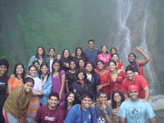
There are a lot of incidents and experiences that I have carried with me from this journey and have no words to describe them.
Ladakh -- a distant land of austere beauty where people live simply and love life. A land where people coexist with one another and with nature in harmony and peace. A land where community ties are strong yet individuality flourishes, and spirituality is an inextricable part of everyday life. Perhaps it would not be sentimental or naive to suggest that such a culture, although it lacks the material and technological advances of the West, represents the ultimate flowering of our human potential, the pinnacle of what we as human beings can aspire to become -- and that in the future of Ladakh will be reflected the fate of our species as a sustainable presence on Earth.
Indeed a tour to Ladakh with an earnest will to explore honestly could be a much more rewarding experience than usual holidays one would have taken to be just free from the work-and-live busy cultural life. Only a personal visit to this land of will answer ones inquisitive mind. So, Welcome and live for your self the experience that is talked about here.
I will never forget this summer; from the moment that everybody met up at station to the time when we said our goodbyes I have had some of the best times ever. Experiencing the Ladakhi culture first hand is something that I will always remember. Going to Leh was amazing, and I had a brilliant time, and it was a great place to get to see. This really was a once in a lifetime experience.
USHMA MEHTA
03 JUNE 2007.
Showing posts with label Ladakh. Show all posts
Showing posts with label Ladakh. Show all posts
Friday, 8 June 2007

The Ink-Blue Lake
An ink-blue lake is what we had been promised. Living in India, where the holiest of rivers, the Ganges had been polluted and even the mightiest of the mountains, the Himalayas had succumbed to the greed of modern development; one actually mused if such a lake was today nothing but a delusion of the modern mind.
Monroe Forester once said, “Hope is always available to us. When we feel defeated, we need only take a deep breath and say, "Yes," and hope will reappear.” That bright sunny afternoon, hope reappeared before my eyes as I caught my first glimpse of an ink blue sheet of liquid, the mighty and picturesque Pangong Lake. An hour by the lake and I found myself closer to paradise than I had ever done before.
A drop of the ocean encompassed between natural pyramids of sandstone, the visit to the Pangong Tso was indeed an enlightening and spiritual experience. Memories of that divine afternoon now lay on my shelf in the form of one smooth pebble which I picked up amongst the countless shiny stones, natural gems, crystals, rocks, and slates that decorated the banks of the Tso.
----------------------------------------------------------------------------------------
just beffore the deadline :)
Monroe Forester once said, “Hope is always available to us. When we feel defeated, we need only take a deep breath and say, "Yes," and hope will reappear.” That bright sunny afternoon, hope reappeared before my eyes as I caught my first glimpse of an ink blue sheet of liquid, the mighty and picturesque Pangong Lake. An hour by the lake and I found myself closer to paradise than I had ever done before.
A drop of the ocean encompassed between natural pyramids of sandstone, the visit to the Pangong Tso was indeed an enlightening and spiritual experience. Memories of that divine afternoon now lay on my shelf in the form of one smooth pebble which I picked up amongst the countless shiny stones, natural gems, crystals, rocks, and slates that decorated the banks of the Tso.
----------------------------------------------------------------------------------------
just beffore the deadline :)
Thursday, 7 June 2007
geography of ladakh
http://en.wikipedia.org/wiki/Ladakh#Geography june 2nd
Geography
Main article: Geography of Ladakh
Map of the central Ladakh region
Landscape in Ladakh
Ladakh is India’s highest plateau with much of it being over 3,000 m(9,800 ft).[4] It spans the Himalayan and Karakoram mountain ranges and the upper Indus River valley. Historical Ladakh includes the fairly populous main Indus valley, the more remote Zangskar (in the south) and Nubra valleys (to the north over Khardung La), the almost deserted Aksai Chin, and Kargil and Suru Valley areas to the west (Kargil being the second most important town in Ladakh). Before partition, Baltistan (now under Pakistani administration) was a district in Ladakh. Skardu was the winter capital of Ladakh while Leh was the summer capital.
The mountain ranges in this region were formed over a period of 45 million years by the folding of the Indian plate into the more stationary Eurasian Plate. The drift continues, causing frequent earthquakes in the Himalayan region.[θ][9] The peaks in the Ladakh range are at a medium altitude close to the Zoji-la (5,000–5,500 m or 16,000–18,050 ft), and increase towards south-east, reaching a climax in the twin summits of Nun-Kun (7000 m or 23,000 ft).
The Suru and Zangskar valleys form a great trough enclosed by the Himalayas and the Zanskar range. Rangdum is the highest inhabited region in the Suru valley, after which the valley rises to 4,400 m (14,436 ft) at Pensi-la, the gateway to Zanskar. Kargil, the only town in the Suru valley, was an important staging post on the routes of the trade caravans before 1947, being more or less equidistant, at about 230 kilometres from Srinagar, Leh, Skardu, and Padum. The Zangskar valley lies in the troughs of the Stod and the Lungnak rivers. The region experiences heavy snowfall; the Pensi-la is open only between June and mid-October. The Indus river is the backbone of Ladakh. All major historical and current towns — Shey, Leh, Basgo, and Tingmosgang, are situated close to the river.
The Ladakh range has no major peaks; its average height is a little less than 6,000 m (19,700 ft), and few of its passes are less than 5,000 m (16,400 ft). The Pangong range runs parallel to the Ladakh range about 100 km northwest from Chushul, along the southern shore of the Pangong Lake. Its highest range is 6,700 m (22,000 ft), and the northern slopes are heavily glaciated. The region comprising the valley of Shayok and Nubra rivers is known as Nubra. The Karakoram range in Ladakh is not as mighty as in Baltistan.[ι] North of the Karakoram lies the Kunlun. Thus, between Leh and eastern Central Asia, there is a triple barrier — Ladakh range, Karakoram range, and Kunlun. Nevertheless, a major trade route was established between Leh and Yarkand.
Monthly average temperature in Leh.
Ladakh is a high altitude desert as the Himalayas create a rain shadow, denying entry to monsoon clouds. The main source of water is the winter snowfall on the mountains. Recent flooding of the Indus river in the region has been attributed either to abnormal rain patterns, or the retreating of glaciers, both of which might be linked to global warming.[10] The Leh Nutrition Project, headed by Chewang Norphel, also known as the 'Glacier Man', currently creates artificial glaciers as one solution for this problem.[1][2]
Phyang Gompa, Ladakh, IndiaThe regions on the north flank of the Himalayas — Dras, the Suru valley and Zanskar — experience heavy snowfall and remain virtually cut off from the rest of the country for several months in the year. Summers are short, though they are long enough to grow crops in the lower reaches of the Suru valley. The summer weather is dry and pleasant, with average temperatures between 10–20 °C (50–70 °F), while in winter, the temperature may dip to −15 °C (5 °F). The proportion of oxygen is less than in many other places at comparable altitudes because of lack of vegetation. There is little moisture to temper the effects of rarefied air. Ladakh lies in the Very High Damage Risk cyclone
Karakoram is a mountain range spanning the borders between Pakistan, China, and India, located in the regions of Gilgit, Ladakh and Baltistan. It is one of the Greater Ranges of Asia, often considered together with the Himalaya, but not technically part of that range. Karakoram means "black gravel" in Turkic, as many of its glaciers are covered in rubble.
The Karakoram is home to more than sixty peaks above 7,000m (22,960 ft), including K2, the second highest peak of the world (8,611 m, 28,244 ft). Most of these peaks are in the Hunza of Pakistan. The range is about 500 km (300 mi) in length, and is the most heavily glaciated part of the world outside of the polar regions. The Siachen Glacier at 70 km and the Biafo Glacier at 63 km rank as the world's second and third longest glaciers outside the polar regions.[1]
The Karakoram is bounded on the northeast by the edge of the Tibetan Plateau, and on the north by the Wakhan Corridor and the Pamir Mountains. Just to the west of the northwest end of the Karakoram lies the Hindu Raj range, beyond which is the Hindu Kush range. The southern boundary of the Karakoram is formed by the Gilgit, Indus, and Shyok Rivers, which separate the range from the northwestern end of the Himalaya range proper.
Due to its altitude and ruggedness, the Karakoram is much less inhabited than parts of the Himalayas further east. European explorers first visited early in the 19th century, followed by British surveyors starting in 1856.
The Muztagh Pass was crossed in 1887 by the expedition of Colonel Francis Younghusband and the valleys above the Hunza River were explored by George Cockerill in 1892. Explorations in the 1910s and 1920s established most of the geography of the region.
Marcel Ichac made a film entitled "Karakoram", chronicling a French expedition to the range in 1936. The film won the Silver Lion at the Venice film festival of 1937.
A portion of the Karakoram, disputed between India and China, has been re-created as a scale model by the Chinese government
http://en.wikipedia.org/wiki/Indus_River
The Indus River (Urdu: سندھ Sindh; Sindhi: سنڌو Sindh; Sanskrit and Hindi: सिन्धु Sindhu; Persian: Hindu; Pashto: Abasin "Father of Rivers"; Tibetan: Sengge Chu "Lion River"; Chinese: 印度 Yìndù; Greek: Ινδuσ Indus) is the longest and most important river in Pakistan and one of the most important rivers on the Indian subcontinent. Originating in the Tibetan plateau in the vicinity of Lake Mansarovar, the river runs a course through Ladakh, Jammu and Kashmir, India and Northern Areas, flowing through the North in a southernly direction along the entire length of country, to merge into the Arabian Sea near Pakistan's port city Karachi. The total length of the river is 3200 km (1988 miles). The river has a total drainage area exceeding 450,000 square miles. The river's estimated annual flow stands at around 207 cubic kilometres. Beginning at the heights of the world with glaciers, the river feeds the ecosystem of temperate forests, plains and arid countryside. Together with the rivers Chenab, Ravi, Sutlej, Jhelum, Beas and the extinct Sarasvati River, the Indus forms the Sapta Sindhu ("Seven Rivers") delta in the Sindh province of Pakistan. It has 20 major tributaries
The ultimate source of the Indus is in Tibet; it begins at the confluence of the Sengge and Gar rivers that drain the Nganglong Kangri and Gangdise Shan mountain ranges. The Indus then flows northwest through Ladakh-Baltistan into Gilgit, just south of the Karakoram range
Nubra Valley
From Wikipedia, the free encyclopedia
Jump to: navigation, search
Image:Panamic village, nubra valley.jpg
Panamic Village, Nubra Valley
Nubra Valley is situated about 150 km north of Leh, the capital town of Ladakh, Jammu and Kashmir, India. The common way to access this valley is to travel over the Khardung La from Leh where one will first encounter the Shyok Valley. To enter the Nubra valley, one must cross over the Shyok River via a small bridge and pass through a military checkpoint. An "Inner Line" permit is required to pass. The Nubra valley contains the small towns of Sumur and Panamik. Sumur has a Buddhist gompa or monastery while Panamik is noted for its hot springs.
There are two villages accessible to foreigners in the Shyok Valley - Disket and Hundar. Disket is home to a busy and dramatically positioned gompa. Hundar is one of those rare places on earth where you can see in one place the splendid beauty of a desert with bactrian camels (two-humped), sand dunes, rolling mountains and snow peaks.
Nubra River
From Wikipedia, the free encyclopedia
Jump to: navigation, search
The Nubra River is a tributary of the Shyok River, which flows into the Indus River. It flows in the Ladakh area of Jammu and Kashmir.
http://www.jktourism.org/cities/ladakh/site-see/valley.htm# June 7, 2007
The Nubra Valley Circuit
Leh-Khardung-la-Khalsar-Tirit-Tegar-Sumur-Panamik and return.
A Bactrian camel in Nubra valley
The name Nubra is applied to the region comprising the valley of the river Nubra and that of the Shayok, both above and below their confluence, where they meander in many shifting channels over a broad sandy plain, before flowing off to the north-west to join the Indus in Baltistan. The Shayok and Nubra rivers drain the east and west sides of the Saser sub-range of Karakoram. The route from Leh crosses over the Khardung-la, the highest motorable road in the world. The line of the road is different from that of the old pony-trail, longer and actually higher (18,300 ft 5,578 m). The view from the top is amazing. One can see all the way south over the Indus valley to the seemingly endless peaks and ridges of the Zanskar range, and north to the giants of the Saser massif. For several kilometres, on each side of the pass, the road, covered by deep snow in winter, is rough. For the rest of the way the road is good. At the confluence of the two rivers there is no dearth of water, but the sandy soil is not suitable for agriculture, which is confined to the alluvial fans where side streams drain into the main valley. The valley floor itself is covered with dense thickets of a thorny shrub, which the villagers use for fuel and for fencing, though there is now less need for this than there was in the days of the caravan trade with Central Asia when up to 10,000 horses a year are said to traverse the distri ct. The villages are large and prosperous, and have thick plantations of willow and poplar. The altitude is a little less than that of Leh, varying between 10,000 ft (3,231 m) at Hundar, and 10,600 ft (3231 m) at Panamik. Summer temperatures vary between 15oC and 28oC.The main village is Deskit, which has a bazaar comprising of single line of shops, and a gompa situated on a rocky spur above the village with a commanding view. From Deskit, the route follows the course of the Shayok to Hundar, past an area of rolling sand dunes, with their contours liable to shift with every gale. There is a small population of the shaggy double-humped Bactrian camels, which in the old days were used as pack animals on the Central Asian trade route. During the past 50 years, they have been bred for transport purposes in Nubra. Today visitors to Nubra can use these animals for going on camel safaris.
Bactrian camels among the sand dunes of nubra
The other circuit proceeds up the Nubra River, taking in the pretty villages of Tirit, Lukung, Tegar and Sumur. Nubra's other major monastery. Samsta-ling is situated on the mountainside just above Sumur. This was the route taken by the trade caravans. Panamik, the last village on this circuit, was at that time a busy centre, being the last major settlement before the caravans entered into the mountains of Karakoram and the Kun-Lu. Here they halted for a few days to make final preparations for the journey across the mountains, or to recuperate on the way back. The Government maintained a granary to sell food grains for the men and even for the horses. But this arrangement was insufficient for the amount of the traffic, and the villagers made huge profits, selling grain and fodder and letting out their fodder-fields for the horses to graze in. Today, Panamik is a sleepy village, its inhabitants quietly going about their work in the fields. On the mountainside above the village, hot water bubbles out of the earth in thermal springs, reputed to have therapeutic qualities. Across the river, clinging to the mountains, are a few trees rooted among the rocks surrounding the tiny Ensa gompa.
. http://www.jktourism.org/cities/ladakh/site-see/valley.htm#
the Pangong Lake, situated at an altitude of 14,000 ft (4,267m). It is a long narrow basin of inland drainage, hardly 6 to 7 kms at its widest point, and over 130 kms long, and bisected by the international border between India and China. Spangmik, the farthest point up to which foreigners are permitted, is about 7 kms along the southern shore from the head of the lake. It presents a spectacular view of the mountains of the Chang-chenmo range to the north, their reflections shimmering in the ever-changing blues and greens of the lake’s brackish waters. Above Spangmik are the glaciers and snow-capped peaks of the Pangong range. Spangmik and a scattering of other tiny villages along the lake's southern shore are the summer homes of a scanty population of Chang-pa, the nomadic herdsmen of Tibet and southeast Ladakh. The Pangong Chang-pa cultivate sparse crops of barley and peas in summer. It is in winter that they unfold their yak wool tents called rebo, and take the flocks of sheep and pashmina goats out to the distant pastures.
http://www.jktourism.org/cities/ladakh/site-see/valley.htm# june 7th
View of Suru Valley near Kargil
About 15,000 sq. kms. in area, Kargil district has an agrarian population of approximately 120,000 people, who cultivate the land, along the course of the drainage system, wherever artificial irrigation from mountain streams is possible. About 85 % are Muslims, mainly of the Shia sect, Islam having been introduced to the original Buddhist population around the middle of the 16th century by missionaries from Kashmir and Central Asia. Their descendants, locally titled Agha, are mostly religious scholars who continue to hold sway over the population, even as the age-old traditions of Buddhist and animistic origin are discernible in the culture. Many elements of the ancient supernatural belief systems, especially many traditions connected with agricultural practices, are still followed with subdued reverence.
.Eurasian Plate
http://en.wikipedia.org/wiki/Eurasian_Plate
From Wikipedia, the free encyclopedia
Jump to: navigation, search
The Eurasian plate, shown in green
The Eurasian Plate is a tectonic plate covering Eurasia (a landmass consisting of the continents Europe and Asia) except that it does not cover the Indian subcontinent, the Arabian subcontinent, and the area east of the Verkhoyansk Range in East Siberia. It extends westward to the Mid-Atlantic Ridge. If only the part west of the Ural Mountains is considered, the term European Plate is sometimes applied.
The easterly side is a boundary with the North American Plate to the north and a boundary with the Philippine Plate to the south, and possibly with the Okhotsk Plate and the Amurian Plate. The southerly side is a boundary with the African Plate to the west, the Arabian Plate in the middle and the Indo-Australian Plate to the east. The westerly side is a divergent boundary with the North American Plate forming the northernmost part of the Mid-Atlantic Ridge. It is the 3rd largest tectonic plate.
This geology article is a stub. You can help Wikipedia by expanding it.
Retrieved from "http://en.wikipedia.org/wiki/Eurasian_Plate"
The India or Indian Plate is a minor tectonic plate. Part of the major Indo-Australian Plate, it contains the subcontinent of India and a portion of the basin under the Indian Ocean.
About 90 million years ago, in the late Cretaceous Period, the India Plate split from Madagascar off the east coast of Africa. It began moving north, at about 15 cm/yr (6 in/yr), and began colliding with Asia between 50 and 55 million years ago, in the Eocene epoch of the Cenozoic Era. During this time, the India Plate covered a distance of 2,000 to 3,000 km (1,200 to 1,900 mi), and moved faster than any other known plate.
The collision with the Eurasian Plate along the boundary between India and Nepal formed the orogenic belt that created the Tibetan Plateau and the Himalaya Mountains, as sediment bunched up like earth before a plow.
The India Plate is currently moving northeast at 5 cm/yr (2 in/yr), while the Eurasian Plate is moving north at only 2 cm/yr (0.8 in/yr). This is causing the Eurasian Plate to deform, and the India Plate to compress at a rate of 4 mm/yr (0.15 in/yr).
//
[
Geography
Main article: Geography of Ladakh
Map of the central Ladakh region
Landscape in Ladakh
Ladakh is India’s highest plateau with much of it being over 3,000 m(9,800 ft).[4] It spans the Himalayan and Karakoram mountain ranges and the upper Indus River valley. Historical Ladakh includes the fairly populous main Indus valley, the more remote Zangskar (in the south) and Nubra valleys (to the north over Khardung La), the almost deserted Aksai Chin, and Kargil and Suru Valley areas to the west (Kargil being the second most important town in Ladakh). Before partition, Baltistan (now under Pakistani administration) was a district in Ladakh. Skardu was the winter capital of Ladakh while Leh was the summer capital.
The mountain ranges in this region were formed over a period of 45 million years by the folding of the Indian plate into the more stationary Eurasian Plate. The drift continues, causing frequent earthquakes in the Himalayan region.[θ][9] The peaks in the Ladakh range are at a medium altitude close to the Zoji-la (5,000–5,500 m or 16,000–18,050 ft), and increase towards south-east, reaching a climax in the twin summits of Nun-Kun (7000 m or 23,000 ft).
The Suru and Zangskar valleys form a great trough enclosed by the Himalayas and the Zanskar range. Rangdum is the highest inhabited region in the Suru valley, after which the valley rises to 4,400 m (14,436 ft) at Pensi-la, the gateway to Zanskar. Kargil, the only town in the Suru valley, was an important staging post on the routes of the trade caravans before 1947, being more or less equidistant, at about 230 kilometres from Srinagar, Leh, Skardu, and Padum. The Zangskar valley lies in the troughs of the Stod and the Lungnak rivers. The region experiences heavy snowfall; the Pensi-la is open only between June and mid-October. The Indus river is the backbone of Ladakh. All major historical and current towns — Shey, Leh, Basgo, and Tingmosgang, are situated close to the river.
The Ladakh range has no major peaks; its average height is a little less than 6,000 m (19,700 ft), and few of its passes are less than 5,000 m (16,400 ft). The Pangong range runs parallel to the Ladakh range about 100 km northwest from Chushul, along the southern shore of the Pangong Lake. Its highest range is 6,700 m (22,000 ft), and the northern slopes are heavily glaciated. The region comprising the valley of Shayok and Nubra rivers is known as Nubra. The Karakoram range in Ladakh is not as mighty as in Baltistan.[ι] North of the Karakoram lies the Kunlun. Thus, between Leh and eastern Central Asia, there is a triple barrier — Ladakh range, Karakoram range, and Kunlun. Nevertheless, a major trade route was established between Leh and Yarkand.
Monthly average temperature in Leh.
Ladakh is a high altitude desert as the Himalayas create a rain shadow, denying entry to monsoon clouds. The main source of water is the winter snowfall on the mountains. Recent flooding of the Indus river in the region has been attributed either to abnormal rain patterns, or the retreating of glaciers, both of which might be linked to global warming.[10] The Leh Nutrition Project, headed by Chewang Norphel, also known as the 'Glacier Man', currently creates artificial glaciers as one solution for this problem.[1][2]
Phyang Gompa, Ladakh, IndiaThe regions on the north flank of the Himalayas — Dras, the Suru valley and Zanskar — experience heavy snowfall and remain virtually cut off from the rest of the country for several months in the year. Summers are short, though they are long enough to grow crops in the lower reaches of the Suru valley. The summer weather is dry and pleasant, with average temperatures between 10–20 °C (50–70 °F), while in winter, the temperature may dip to −15 °C (5 °F). The proportion of oxygen is less than in many other places at comparable altitudes because of lack of vegetation. There is little moisture to temper the effects of rarefied air. Ladakh lies in the Very High Damage Risk cyclone
Karakoram is a mountain range spanning the borders between Pakistan, China, and India, located in the regions of Gilgit, Ladakh and Baltistan. It is one of the Greater Ranges of Asia, often considered together with the Himalaya, but not technically part of that range. Karakoram means "black gravel" in Turkic, as many of its glaciers are covered in rubble.
The Karakoram is home to more than sixty peaks above 7,000m (22,960 ft), including K2, the second highest peak of the world (8,611 m, 28,244 ft). Most of these peaks are in the Hunza of Pakistan. The range is about 500 km (300 mi) in length, and is the most heavily glaciated part of the world outside of the polar regions. The Siachen Glacier at 70 km and the Biafo Glacier at 63 km rank as the world's second and third longest glaciers outside the polar regions.[1]
The Karakoram is bounded on the northeast by the edge of the Tibetan Plateau, and on the north by the Wakhan Corridor and the Pamir Mountains. Just to the west of the northwest end of the Karakoram lies the Hindu Raj range, beyond which is the Hindu Kush range. The southern boundary of the Karakoram is formed by the Gilgit, Indus, and Shyok Rivers, which separate the range from the northwestern end of the Himalaya range proper.
Due to its altitude and ruggedness, the Karakoram is much less inhabited than parts of the Himalayas further east. European explorers first visited early in the 19th century, followed by British surveyors starting in 1856.
The Muztagh Pass was crossed in 1887 by the expedition of Colonel Francis Younghusband and the valleys above the Hunza River were explored by George Cockerill in 1892. Explorations in the 1910s and 1920s established most of the geography of the region.
Marcel Ichac made a film entitled "Karakoram", chronicling a French expedition to the range in 1936. The film won the Silver Lion at the Venice film festival of 1937.
A portion of the Karakoram, disputed between India and China, has been re-created as a scale model by the Chinese government
http://en.wikipedia.org/wiki/Indus_River
The Indus River (Urdu: سندھ Sindh; Sindhi: سنڌو Sindh; Sanskrit and Hindi: सिन्धु Sindhu; Persian: Hindu; Pashto: Abasin "Father of Rivers"; Tibetan: Sengge Chu "Lion River"; Chinese: 印度 Yìndù; Greek: Ινδuσ Indus) is the longest and most important river in Pakistan and one of the most important rivers on the Indian subcontinent. Originating in the Tibetan plateau in the vicinity of Lake Mansarovar, the river runs a course through Ladakh, Jammu and Kashmir, India and Northern Areas, flowing through the North in a southernly direction along the entire length of country, to merge into the Arabian Sea near Pakistan's port city Karachi. The total length of the river is 3200 km (1988 miles). The river has a total drainage area exceeding 450,000 square miles. The river's estimated annual flow stands at around 207 cubic kilometres. Beginning at the heights of the world with glaciers, the river feeds the ecosystem of temperate forests, plains and arid countryside. Together with the rivers Chenab, Ravi, Sutlej, Jhelum, Beas and the extinct Sarasvati River, the Indus forms the Sapta Sindhu ("Seven Rivers") delta in the Sindh province of Pakistan. It has 20 major tributaries
The ultimate source of the Indus is in Tibet; it begins at the confluence of the Sengge and Gar rivers that drain the Nganglong Kangri and Gangdise Shan mountain ranges. The Indus then flows northwest through Ladakh-Baltistan into Gilgit, just south of the Karakoram range
Nubra Valley
From Wikipedia, the free encyclopedia
Jump to: navigation, search
Image:Panamic village, nubra valley.jpg
Panamic Village, Nubra Valley
Nubra Valley is situated about 150 km north of Leh, the capital town of Ladakh, Jammu and Kashmir, India. The common way to access this valley is to travel over the Khardung La from Leh where one will first encounter the Shyok Valley. To enter the Nubra valley, one must cross over the Shyok River via a small bridge and pass through a military checkpoint. An "Inner Line" permit is required to pass. The Nubra valley contains the small towns of Sumur and Panamik. Sumur has a Buddhist gompa or monastery while Panamik is noted for its hot springs.
There are two villages accessible to foreigners in the Shyok Valley - Disket and Hundar. Disket is home to a busy and dramatically positioned gompa. Hundar is one of those rare places on earth where you can see in one place the splendid beauty of a desert with bactrian camels (two-humped), sand dunes, rolling mountains and snow peaks.
Nubra River
From Wikipedia, the free encyclopedia
Jump to: navigation, search
The Nubra River is a tributary of the Shyok River, which flows into the Indus River. It flows in the Ladakh area of Jammu and Kashmir.
http://www.jktourism.org/cities/ladakh/site-see/valley.htm# June 7, 2007
The Nubra Valley Circuit
Leh-Khardung-la-Khalsar-Tirit-Tegar-Sumur-Panamik and return.
A Bactrian camel in Nubra valley
The name Nubra is applied to the region comprising the valley of the river Nubra and that of the Shayok, both above and below their confluence, where they meander in many shifting channels over a broad sandy plain, before flowing off to the north-west to join the Indus in Baltistan. The Shayok and Nubra rivers drain the east and west sides of the Saser sub-range of Karakoram. The route from Leh crosses over the Khardung-la, the highest motorable road in the world. The line of the road is different from that of the old pony-trail, longer and actually higher (18,300 ft 5,578 m). The view from the top is amazing. One can see all the way south over the Indus valley to the seemingly endless peaks and ridges of the Zanskar range, and north to the giants of the Saser massif. For several kilometres, on each side of the pass, the road, covered by deep snow in winter, is rough. For the rest of the way the road is good. At the confluence of the two rivers there is no dearth of water, but the sandy soil is not suitable for agriculture, which is confined to the alluvial fans where side streams drain into the main valley. The valley floor itself is covered with dense thickets of a thorny shrub, which the villagers use for fuel and for fencing, though there is now less need for this than there was in the days of the caravan trade with Central Asia when up to 10,000 horses a year are said to traverse the distri ct. The villages are large and prosperous, and have thick plantations of willow and poplar. The altitude is a little less than that of Leh, varying between 10,000 ft (3,231 m) at Hundar, and 10,600 ft (3231 m) at Panamik. Summer temperatures vary between 15oC and 28oC.The main village is Deskit, which has a bazaar comprising of single line of shops, and a gompa situated on a rocky spur above the village with a commanding view. From Deskit, the route follows the course of the Shayok to Hundar, past an area of rolling sand dunes, with their contours liable to shift with every gale. There is a small population of the shaggy double-humped Bactrian camels, which in the old days were used as pack animals on the Central Asian trade route. During the past 50 years, they have been bred for transport purposes in Nubra. Today visitors to Nubra can use these animals for going on camel safaris.
Bactrian camels among the sand dunes of nubra
The other circuit proceeds up the Nubra River, taking in the pretty villages of Tirit, Lukung, Tegar and Sumur. Nubra's other major monastery. Samsta-ling is situated on the mountainside just above Sumur. This was the route taken by the trade caravans. Panamik, the last village on this circuit, was at that time a busy centre, being the last major settlement before the caravans entered into the mountains of Karakoram and the Kun-Lu. Here they halted for a few days to make final preparations for the journey across the mountains, or to recuperate on the way back. The Government maintained a granary to sell food grains for the men and even for the horses. But this arrangement was insufficient for the amount of the traffic, and the villagers made huge profits, selling grain and fodder and letting out their fodder-fields for the horses to graze in. Today, Panamik is a sleepy village, its inhabitants quietly going about their work in the fields. On the mountainside above the village, hot water bubbles out of the earth in thermal springs, reputed to have therapeutic qualities. Across the river, clinging to the mountains, are a few trees rooted among the rocks surrounding the tiny Ensa gompa.
. http://www.jktourism.org/cities/ladakh/site-see/valley.htm#
the Pangong Lake, situated at an altitude of 14,000 ft (4,267m). It is a long narrow basin of inland drainage, hardly 6 to 7 kms at its widest point, and over 130 kms long, and bisected by the international border between India and China. Spangmik, the farthest point up to which foreigners are permitted, is about 7 kms along the southern shore from the head of the lake. It presents a spectacular view of the mountains of the Chang-chenmo range to the north, their reflections shimmering in the ever-changing blues and greens of the lake’s brackish waters. Above Spangmik are the glaciers and snow-capped peaks of the Pangong range. Spangmik and a scattering of other tiny villages along the lake's southern shore are the summer homes of a scanty population of Chang-pa, the nomadic herdsmen of Tibet and southeast Ladakh. The Pangong Chang-pa cultivate sparse crops of barley and peas in summer. It is in winter that they unfold their yak wool tents called rebo, and take the flocks of sheep and pashmina goats out to the distant pastures.
http://www.jktourism.org/cities/ladakh/site-see/valley.htm# june 7th
View of Suru Valley near Kargil
About 15,000 sq. kms. in area, Kargil district has an agrarian population of approximately 120,000 people, who cultivate the land, along the course of the drainage system, wherever artificial irrigation from mountain streams is possible. About 85 % are Muslims, mainly of the Shia sect, Islam having been introduced to the original Buddhist population around the middle of the 16th century by missionaries from Kashmir and Central Asia. Their descendants, locally titled Agha, are mostly religious scholars who continue to hold sway over the population, even as the age-old traditions of Buddhist and animistic origin are discernible in the culture. Many elements of the ancient supernatural belief systems, especially many traditions connected with agricultural practices, are still followed with subdued reverence.
.Eurasian Plate
http://en.wikipedia.org/wiki/Eurasian_Plate
From Wikipedia, the free encyclopedia
Jump to: navigation, search
The Eurasian plate, shown in green
The Eurasian Plate is a tectonic plate covering Eurasia (a landmass consisting of the continents Europe and Asia) except that it does not cover the Indian subcontinent, the Arabian subcontinent, and the area east of the Verkhoyansk Range in East Siberia. It extends westward to the Mid-Atlantic Ridge. If only the part west of the Ural Mountains is considered, the term European Plate is sometimes applied.
The easterly side is a boundary with the North American Plate to the north and a boundary with the Philippine Plate to the south, and possibly with the Okhotsk Plate and the Amurian Plate. The southerly side is a boundary with the African Plate to the west, the Arabian Plate in the middle and the Indo-Australian Plate to the east. The westerly side is a divergent boundary with the North American Plate forming the northernmost part of the Mid-Atlantic Ridge. It is the 3rd largest tectonic plate.
This geology article is a stub. You can help Wikipedia by expanding it.
Retrieved from "http://en.wikipedia.org/wiki/Eurasian_Plate"
The India or Indian Plate is a minor tectonic plate. Part of the major Indo-Australian Plate, it contains the subcontinent of India and a portion of the basin under the Indian Ocean.
About 90 million years ago, in the late Cretaceous Period, the India Plate split from Madagascar off the east coast of Africa. It began moving north, at about 15 cm/yr (6 in/yr), and began colliding with Asia between 50 and 55 million years ago, in the Eocene epoch of the Cenozoic Era. During this time, the India Plate covered a distance of 2,000 to 3,000 km (1,200 to 1,900 mi), and moved faster than any other known plate.
The collision with the Eurasian Plate along the boundary between India and Nepal formed the orogenic belt that created the Tibetan Plateau and the Himalaya Mountains, as sediment bunched up like earth before a plow.
The India Plate is currently moving northeast at 5 cm/yr (2 in/yr), while the Eurasian Plate is moving north at only 2 cm/yr (0.8 in/yr). This is causing the Eurasian Plate to deform, and the India Plate to compress at a rate of 4 mm/yr (0.15 in/yr).
//
[
Dry Toilets
Most of us have been brought up to believe that human waste is disgusting and offensive and best flushed out of sight. But not if you are a Ladakhi, born and brought up in the cold desert regions of the Himalayan mountains. Here, human excreta is an important source of manure for the fields. The land here is not fertile, but the Ladakhis have made it so, over many generations, with their many ingenious methods. For one, water is brought to the fields (sometimes over several kilometres) by a very elaborate network of yura or canals that traverse the barren landscape. Water from melting snow from the upper parts of the mountains reaches many villages only by the evening. This is stored in a `zing', a man-made storage pond. But water alone cannot do the trick. The soil has to yield and for that it has to be made fertile. This problem has largely been addressed by the traditional system of dry toilets. Almost all over Ladakh, the toilet is a hole in the floor of a room that is well above the ground. The human waste falls into a sealed room below, where it is allowed to decompose over time. The manure that forms is usually cleared out once a year and spread out on the fields. The Ladakhi system of toilets is dry as no water is used. Instead, a shovel full of earth is thrown in after use. Occasionally ash is also used. This keeps the toilet odour-free. This system, which has been in use for many years, has provided the Ladakhi farmer manure for free. And has saved a resource that is very precious in that desert region: water. The Ladakhi system of dry toilets does make for good earth!!
THE HINDU- SUJATHA PADMANABHAN in collaboration with Kalpavriksh/National Biodiversity Strategy and Action Plan.
THE HINDU- SUJATHA PADMANABHAN in collaboration with Kalpavriksh/National Biodiversity Strategy and Action Plan.
ladakh intro
http://www.jktourism.org/cities/ladakh/gen.htm june 7
Area: 97,000 sq kms out of which nearly 38,000 sq. kms are under Chinese Occupation since 1962.
Population: Approx. 2.40 lakh in the 2 districts of Leh & Kargil.
Languages: Ladakhi including Balti / Purgi, Shina or Dardic, Urdu / Hindi.
Ethnic composition: Mongoloid/Tibetan, Dardic and assorted Indo-Aryan elements.
Altitude: Leh 3505 m, Kargil 2750 m
Temperature:
Maximum
Minimum
Summer
25oC
8oC
Winter
(-) 5oC
(-) 20oC
Rain-fall : 15cm, 6" (annual average)
Clothing :Cotton & light woollens in summer and heavy woollens including down-filled wind proof upper garments in winter.
Geographical Introduction Ladakh is a land abounding in awesome physical features, set in an enormous and spectacular environment. Bounded by two of the world's mightiest mountain ranges, the Karakoram in the north and the Great Himalaya in the south, it is traversed by two other parallel chains, the Ladakh Range and the Zanskar Range.
In geological terms, this is a young land, formed a few million years ago. Its basic contours, uplifted by tectonic movements, have been modified over the millennia by the process of erosion due to wind and water, sculpted into the form that we see today.
Today a high-altitude desert, shelter ed from the rain-bearing clouds of the Indian monsoon by the barrier of the Great Himalaya, Ladakh was once covered by an extensive lake system, the vestiges of which still exist on its south-east plateaux of Rupshu and Chushul, in the drainage basins or lakes of Tso-moriri, Tso-kar and Pangong-tso. But the main source of water is winter snowfall.Dras, Zanskar and the Suru Valley on the Himalaya's northern flanks receive heavy snow in winter, this feeds the glaciers from which melt water, carried down by streams, irrigates the fields in summer. For the rest of the region, the snow on the peaks is virtually the only source of water. As the crops grow, the villagers pray not for rain, but for sun to melt the glaciers and liberate their water.
Ladakh lies at altitudes ranging from about 9,000 ft (2,750 m) at Kargil to 25,170 ft (7,672m) at Saser Kangri, in the Karakoram Range. Summer temperatures rarely exceed 27C in the shade, while in winter they may at times plummet to minus 20C even in Leh. Surprisingly though, the thin air makes the heat of the sun even more intense than at lower altitudes. It is said that only in Ladakh can a man sitting in the sun with his feet in the shade suffer from sunstroke
Area: 97,000 sq kms out of which nearly 38,000 sq. kms are under Chinese Occupation since 1962.
Population: Approx. 2.40 lakh in the 2 districts of Leh & Kargil.
Languages: Ladakhi including Balti / Purgi, Shina or Dardic, Urdu / Hindi.
Ethnic composition: Mongoloid/Tibetan, Dardic and assorted Indo-Aryan elements.
Altitude: Leh 3505 m, Kargil 2750 m
Temperature:
Maximum
Minimum
Summer
25oC
8oC
Winter
(-) 5oC
(-) 20oC
Rain-fall : 15cm, 6" (annual average)
Clothing :Cotton & light woollens in summer and heavy woollens including down-filled wind proof upper garments in winter.
Geographical Introduction Ladakh is a land abounding in awesome physical features, set in an enormous and spectacular environment. Bounded by two of the world's mightiest mountain ranges, the Karakoram in the north and the Great Himalaya in the south, it is traversed by two other parallel chains, the Ladakh Range and the Zanskar Range.
In geological terms, this is a young land, formed a few million years ago. Its basic contours, uplifted by tectonic movements, have been modified over the millennia by the process of erosion due to wind and water, sculpted into the form that we see today.
Today a high-altitude desert, shelter ed from the rain-bearing clouds of the Indian monsoon by the barrier of the Great Himalaya, Ladakh was once covered by an extensive lake system, the vestiges of which still exist on its south-east plateaux of Rupshu and Chushul, in the drainage basins or lakes of Tso-moriri, Tso-kar and Pangong-tso. But the main source of water is winter snowfall.Dras, Zanskar and the Suru Valley on the Himalaya's northern flanks receive heavy snow in winter, this feeds the glaciers from which melt water, carried down by streams, irrigates the fields in summer. For the rest of the region, the snow on the peaks is virtually the only source of water. As the crops grow, the villagers pray not for rain, but for sun to melt the glaciers and liberate their water.
Ladakh lies at altitudes ranging from about 9,000 ft (2,750 m) at Kargil to 25,170 ft (7,672m) at Saser Kangri, in the Karakoram Range. Summer temperatures rarely exceed 27C in the shade, while in winter they may at times plummet to minus 20C even in Leh. Surprisingly though, the thin air makes the heat of the sun even more intense than at lower altitudes. It is said that only in Ladakh can a man sitting in the sun with his feet in the shade suffer from sunstroke
Archery
Archery is an ancestral sport of Ladakh, which is part of the culture. In Leh and its surrounding villages, archery festivals are held during the summer months, with a lot of fun and fanfare. They are competitive events, to which all the surrounding villages send their teams. The sport itself is conducted with strict etiquette, to the accompaniment of the music of surna and daman (oboe and drum). As important as the sport itself are the interludes of dancing and other entertainment. Chang, the local barley beer, flows freely, but there is rarely any rowdiness. The crowds attend in their Sunday best, the men invariably in traditional dress and the women wearing their brightest brocade mantles and their heaviest jewellery. Archery may be the pretext for the gathering, but partying is the thing. In Kargil area, on the other hand, the archery competitions are more serious and bereft of the dancing and music, and these are held in early spring, at the time of the thawing of the winter snow and frost.
Each competing teams must be captained by someone from an aristocratic family, preferably the senior member present. Only particular families make the Scythian bow. The central shaft is made of mulberry wood. Slivers from the horns of the ibex goat are pasted on this shaft, giving them great tensile strength. The craftsmen of Trespon village in Kargil sell these bows to almost all of Ladakh. There is a mock battle of the sexes in the finale of the tournament. It consists of hitting a melong, which is made of brass. Before the glass reached Ladakh the melong was used as a mirror. Therefore, it is supposed to represent the fairer sex. The melong is placed on the target and if the archers manage to hit the melong, it is considered a victory for the men. In most parts of Ladakh, there is feasting after the tournament is over. Everyone participates in these feasts, regardless of class or religion. Apart from dancing, short plays are staged on such occasions.
Each competing teams must be captained by someone from an aristocratic family, preferably the senior member present. Only particular families make the Scythian bow. The central shaft is made of mulberry wood. Slivers from the horns of the ibex goat are pasted on this shaft, giving them great tensile strength. The craftsmen of Trespon village in Kargil sell these bows to almost all of Ladakh. There is a mock battle of the sexes in the finale of the tournament. It consists of hitting a melong, which is made of brass. Before the glass reached Ladakh the melong was used as a mirror. Therefore, it is supposed to represent the fairer sex. The melong is placed on the target and if the archers manage to hit the melong, it is considered a victory for the men. In most parts of Ladakh, there is feasting after the tournament is over. Everyone participates in these feasts, regardless of class or religion. Apart from dancing, short plays are staged on such occasions.
The Sindhu Darshan Festival
Sindhu Darshan Festival, as the name suggests, is a celebration of River Sindhu, also known as the Indus, the river that gave India its name. This annual festival is held every June at Leh and Ladakh. Sindhu Darshan is a movement, which rediscovered the flowing legend of Ladakh with its imprints of fables, and a 5000 year old history embedded in its fertila e silt, which has enriched human kind for ages. Each fold of the river unfolds a unique culture of the land it passes through - speaking volumes in the same language, to anyone who cares to listen. The mighty Sindhu (Indus) river symbolizes the power and permanence of the ancient Indian civilization which evolved over a period of thousands of years. The archaeological discovery of the Indus Valley civilization which flourished along its banks, has reinforced the antiquity of the Indian civilization. The Sindhu Darshan Festival aims at projecting the Sindhu as a symbol of multi-dimensional cultural identity, communal harmony and peaceful co-existence in India. Whilst promoting tourism to this area, this festival is also a symbolic salute to the brave soldiers of India who have bravely fought the odds at Siachin, Kargil & other places. The festival promises a kaleidoscope of Indian culture and an exciting array of performing arts being brought together at an exciting place. The first time when this Festival was organised in October 1997, over seventy people from all over India had travelled to Leh for a Darshan and Puja of the River Sindhu (Indus) which originates from the Mansarovar in Tibet.
skin protection for winter
How women in faraway villages in the mountains protect their face in winter… the apply a paste made of roots of plants on their faces. Then stick woolen pieces of cloth on it. This they keep for 3-4months. It helps them protect their faces from heavy winds and blizzards, in case they need to venture out in the open during winter. After 3-4months they wash their faces and re-apply the paste n woolen cloth for the rest of the season. Interesting how people in remote areas find solutions to hardships of life and nature. Good and cheap home-made remedies instead of creams with chemicals!!
-Told to us by the PRO of govt. during our visit to polling booths in Leh.
-Told to us by the PRO of govt. during our visit to polling booths in Leh.
People-Ladakh
Features of People
The people of Ladakh are hardy and tough akin to the rugged mountains which surround their dwellings yet very soft and plane at heart .With round faces, short noses, and chinki eyes they resemble more to the people of Tibet and central Asia than of India.
The original population is believed to have been that of Dards, an Indo-Aryan race from down the Indus. But over years, a huge influx from Tibet overwhelmed the culture of the "Dards" and obliterated their racial characteristics. In eastern and central Ladakh, today's population seems to be mostly of Tibetan origin. Further west, in and around Kargil , there is much in the people's appearance that suggests a mixed origin. The exception to this generalization is the "Arghon", a community of Muslims in Leh, the descendants of marriages between local women and Kashmiri or Central Asian merchants.
Influence of Buddhism in Ladakh
Buddhism reached Tibet from India via Ladakh, and there are ancient Buddhist frock engravings all over the region, even in areas like Drass and the lower Suru valley which today are inhabited by an exclusively Muslim population.
The approach to a Buddhist Village is invariably marked by 'Mani' walls, which are ling chest-high structures faced with engraved stones bearing the Mantra "Om Mane Padme Hum" and by 'Chorten', commemorative cairns, like stone pepper-posts. Many villages are crowned with a 'Gompa' or monastery, which may be anything from an imposing complex of temples, prayer halls and monks' dwellings, to a tiny hermitage housing a single image and home to a solitary Lama.
The Muslim Inhabitants
Islam too came from the west. A peaceful penetration of the 'Shia' sect spearheaded by missionaries, its success was guaranteed by the early conversion of the Sub-rulers of Drass, Kargil and the Suru Valley. In these areas, 'Mani' walls and Chorten are replaced by mosques often-small unpretentious buildings, or 'Imambaras' imposing structures in the Islamic style, surmounted by domes of sheet metal that gleam cheerfully in the sun.
Women of Ladakh
In Leh area women of both the communities, Buddhist and Muslim, enjoy a greater freedom than other parts of the region. They not only work in the house and field, but also do business and interact freely with men other than their own relations. In Kargil and its adjoining regions on the other hand, it is only in the last few years that women are merging from semi-seclusion and taking jobs other than traditional ones like farming and house-keeping.
Traditional Rituals & Leisure Activities
The natural joie-de-vivre of the Ladakhis is given free rein by the ancient traditions of the region. Monastic and other religious festivals, many of which fall in winter, provide the excuse for convivial gatherings. Summer pastimes all over the region are archery and polo. Among the Buddhists, these often develop into open-air parties accompanied by dance and song, at which 'Chang', the local brew made from fermented barley, flows freely.
Oral Tradition
Of the secular culture, the most important element is the rich oral literature of songs and poems for every occasions, as well as local versions of the "Kesar Saga", the Tibetan national epic. This literature is common to both Buddhists and Muslims.
Ceremonies
Ceremonial and public events are accompanied by the characteristic music of 'Surna' and 'Daman' (Oboe and drum), originally introduced into Ladakh from Muslim Baltistan, but now played only by Buddhist musicians known as "Mons".
The first year of childbirth is marked by celebrations at different intervals of time, Beginning with a function held after 15 days, then after one month, and then again at the end of year. All relatives, neighbors and friends are invited and served with 'Tsampa', butter and sugar, along with tea by the family in which the child is born.
Wedding Process
There is a mix of music and dance, joy and laughter, in the air whenever a marriage is held. The first day is spent in feasting at the bride's house, the second at the groom's place. The bride goes to live in the house of bridegroom after marriage. Boys are usually married or promised for marriage at about 16, girls at about 12. To make a proposal a relative of the boy goes to the house of the girl and gives a ring together with presents of butter, tea and 'Chang'. If the gifts are accepted then the marriage follows some months later. The boy offers a necklace and clothes to the girl. The parents of the girl give the couple clothes, animals and land if they are rich. These gifts are known as a "Raqtqaq" or dowry.
Rules of Inheritance
When the father of the family dies his place is taken by the eldest brother. The other brothers must obey the eldest brother. All inheritance of the family goes to the eldest brother and then to the next brother when he dies. If the family consists of all girls, then the father will bring the husband of the eldest daughter into the house and all land stays in the daughter's name and passes to her first son. Both sets of parents must accept the proposal of the boy for the girl. Usually the marriage is set by both sets of parents, who will choose a suitable partner for their child on the basis of manner, health and ability to earn income and look after a house.
Leisure Activities
Polo and archery are the two favourite past times. In Leh, and may of the villages, archery festivals are held during the summer months, with a lot of fun and fanfare. Different teams from surrounding villages compete with each other in these archery festivals, and the shooting takes place according to strict etiquette, to the accompaniment of the music of surna and daman (oboe and drum). As important as the archery are the interludes of dancing and other entertainment. Chang, the local barley beer, flows freely, but there is rarely any rowdiness.
Unlike the international game, Polo in Ladakh is not exclusively for the rich. Traditionally, almost every village had its polo-ground, and even today it is played with verve in many places.Probably introduced into Ladakh in the mid-17th century by King Sengge Namgyal, Polo played here differs in many respects from the international game. Here, each team consists of six players,and the game lasts for an hour with a ten minute break. Altitude notwithstanding, the hardy local ponies - the best of which come from Zanskar- scarcely seem to suffer, though play can be fast and furious. Each goal is greeted by a bust of music from surna and daman ; and the players often show extraordinary skill. For example, when starting play after a goal the scorer gallops up to midfield holding ball and mallet in the right hand, and throws the ball, hitting it in the same movement towards the opposite goal.
Astrologers and Oracles of Ladakh
The lamas are the vital intermediaries between the human and the spirit worlds. Not only do they perform the rites necessary to propitiate the gods, they also often take on the role of astrologers and oracles who can predict the auspicious time for starting any enterprise, whether ploughing the fields, arranging a marriage or going on a journey. The most famous monk-oracles are those of Matho Gompa. Chosen every three years by a traditional procedure, two monks spend several months in a rigorous regimen of prayer and fasting to prepare and purify themselves for their arduous role. When the time comes they are possessed by the deity, whose spirit enables them to perform feats that would be impossible to anyone in a normal state such as cutting themselves with knives, or sprinting along the gompa's topmost parapet. In this condition, they will answer questions put to them concerning individual and public welfare. However, the spirit is said to be able to detect questions asked by sceptical observers with the intention of testing him, and to react with frenzied anger.
Leh- History
King Sengge Namgyal who ruled Ladakh during 17th century and during whose rule Ladakh was at its greatest shifted his court from Shey to Leh. Leh became the regional capital and very soon the town blossomed into one of the busiest markets on the Silk Route. During the 1920s and 1930s, the broad bazaar that still forms its heart received more than a dozen pony- and camel-trains each day.
Leh's prosperity, managed mainly by the Sunni Muslim merchants whose descendants live in its labyrinthine old quarter, came to an abrupt end with the closure of the Chinese border in the 1950's. However its fortunes begin to look up after India rediscovered the hitherto forgotten capital's strategic value after two wars in quick succession with Pakistan . Today, Khaki-clad Jawans (soldiers) and their families from the nearby military and air force bases are the mainstay of the local economy in winter, when foreign visitors are few and far between.
Gates opened for Tourists
Indian government's decision in 1974 to open Ladakh to foreign tourists was a major shake-up. From the start, Leh bore the brunt of the annual invasion, as busloads of backpackers poured up the road Srinagar. Twenty or so years on, though the main approach is now via Himachal Pradesh rather than Kashmir, the summer influx shows no sign of abating.
Leh has doubled in size and is a far cry from the sleepy Himalayan town of the early 1970's. During July and August tourists stroll shoulder to shoulder down its main street, most of whose old style outfitters and provision stores have been squeezed out by Kashmiri handicraft shops, art emporiums and Tibetan restaurants. Around the Town
Around the Town
Leh has nonetheless retained a more tranquil side, and is a pleasant place to unwind after a long bus journey. Attractions in and around the town itself include the former Palace and Namgyal Tsemo Gompa, perched amid strings of prayer flags above the narrow dusty streets of the Old Quarter.
A short walk north across the fields, the small monastery of Sankar harbours accomplished modern Tantric murals and a thousand beaded Avalokitesvara (also spelt as Avalokiteshvara) deity.
Leh is also a good base for longer day trips out into the Indus Valley. Among the string of picturesque villages and Gompas within reach by bus are Shey, site of a derelict 17th century palace, and the Spectacular Tikse Gompa. Until one has adjusted to the altitude, however, the Only sightseeing one will probably feel up to will be from a guesthouse roof terrace or garden, from where the snowy summits of the majestic Stok-Kangri massif (6,120m), magnified in the crystal clear Ladakhi sunshine, look close enough to touch.
Ladakh
In geological terms, this is a young land, formed only a few million years ago by the buckling and folding of the earth's crust as the Indian sub-continent pushed with irresistible force against the immovable mass of Asia. Its basic contours, uplifted by these unimaginable tectonic movements, have been modified over the millennia by the opposite process of erosion, sculpted into the form we see today by wind and water.
The main source of water in this land remains the winter snowfall. Ladakh was once covered by an extensive lake system, the vestiges of which still exist on its south -east plateaux of Rupshu and Chushul - in drainage basins with evocative names like Tso-moriri, Tsokar,and grandest of all, Pangong-tso. The temperature rarely exceeds 27 degree celcuis in summer while in winter it may drop to minus 20 degree celcuis
Made up of two administrative districts - Leh and Kargil, Ladakh covers a total area of about 59,000 square kilometers. Leh is the chief town. Allied ethnologically and geographically with the Tibet region of China, the area has a predominantly Lamaist Buddhist population. It was nominally a dependency of Tibet. After 1531 it was invaded periodically by Muslims from Kashmir; it was annexed to Kashmir in the mid-19th cent.
However today's Ladakh which forms a part of the state of Jammu and Kashmir in India has some of its areas under the illegal occupation of Pakistan and China
Ladakh History
The region of Ladakh once formed part of the erstwhile Kingdom of Ladakh and for nearly 900 years from the middle of the 10 th century existed as an independent kingdom. After 1531, it was periodically attacked by the Muslims from Kashmir, until it was finally annexed to Kashmir in the mid 19th century. The early colonizers of Ladakh included:- the Indo-Aryan Mons from across the Himalayan range, the Darads from the extreme western Himalayas, and the itinerant nomads from the Tibetan highlands. While Mons are believed to have carried north-Indian Buddhism to these highland valleys, the Darads and Baltis of the lower Indus Valley are credited with the introduction of farming and the Tibetans with the tradition of herding. Its valleys, by virtue of their contiguity with Kashmir, Kishtwar and Kulu, served as the initial receptacles of successive ethnic and cultural waves emanating from across the Great Himalayan range.
Its political fortunes ebbed and flowed over the centuries, and the kingdom, was at its best in the early 17th century under the famous king Sengge Namgyal, whose rule extended across Spiti and western Tibet up to the Mayumla beyond the sacred sites of Mount Kailash and Lake Mansarovar.
During this period Ladakh became recognized as the best trade route between the Pubjab and Central Asia. The merchants and pilgrims who made up the majority of travellers during this period of time, travelled on foot or horseback , taking about 16 days to reach Srinagar; though a man in hurry, riding non-stop and with changes of horse arranged ahead of time all along the route, could do it in as little as three days. These merchants who dealt in textiles and spices, raw silk and carpets, dyestuffs and narcotics entrusted their goods to relays of pony transporters who took about two months to carry them from Amritsar to the Central Asian towns of Yarkand and Knotan. On this long route, Leh was the half-way house, and developed into a bustling entreport, it bazaars thronged with merchants from far countries. This was before the wheel as a means of transport was introduced into Ladakh, which happened only when the Srinagar- Leh motor-road was constructed as recently as the early 1960s.
The 434 km Srinagar-Leh highway follows the historic trade route, thus giving travellers a glimpse of villages that are historically and culturally important. The famous pashm (better known as cashmere) was produced in the high altitudes of eastern Ladakh and western Tibet and transported thorough Leh to Srinagar where skilled artisans transformed it into shawls known the world over for their softness and warmth. Ironically, it was this lucrative trade, that finally spelt the doom of the independent kingdom. It attracted the covetous gaze of Gulab Singh, the ruler of Jammu in the early 19th century, and in 1834, he sent his general Zorawar Singh to invade Ladakh. Hence, followed a decade of war and turmoul, which ended with the emergence of the British as the paramount power in north India.
Ladakh, together with the neighbouring province of Baltistan, was incorporated into the newly created State of Jammu & Kashmir. Just over a century later, this union was disturbed by the partition of India, Baltistan becoming part of Pakistan, while Ladakh remained in India as part of the State of Jammu & Kashmir.
Ladakh
I have never known so much beauty to exist in one land.
It may not be what many people call beautiful, and in a way I am glad that we humans have such different ideas of what is beautiful because we always land up desecrating beauty at its best.
To me, Ladakh is beautiful. And every single time I rummage in my head for a memory of a place there, I feel the same powerful awe that shot through me when I first saw it. Such is Ladakh's intoxicating effect on the first time visitor.
Whenever it was possible to put the scene around me into prose, I did so without hesitation. These are my thoughts at various points during the journey:
It may not be what many people call beautiful, and in a way I am glad that we humans have such different ideas of what is beautiful because we always land up desecrating beauty at its best.
To me, Ladakh is beautiful. And every single time I rummage in my head for a memory of a place there, I feel the same powerful awe that shot through me when I first saw it. Such is Ladakh's intoxicating effect on the first time visitor.
Whenever it was possible to put the scene around me into prose, I did so without hesitation. These are my thoughts at various points during the journey:
At the Hundar Desert...
Looking out at the barren expanse of soft, sandy dunes, I feel at peace in the wilderness.
The quiet rings in my ears and the cool grains of sand between my fingers feel smooth and wonderfully fluid.
The desert holds good memories for me. Memories of a time gone by, a childhood long past. Of starry skies and laughter running through the air.
The sands and my memories fly by.
Whoever said there can't be beauty in barrenness.
Or that you can't find peace in the wild.
At Hemis Gompa...
The chant puts me at ease and the world falls away. There is something about this place and this scene that makes me feel at peace with myself. The monks sing their haunting chants and the younger ones in the order learn their dance for the coming days. I sit and soak it all in. Not wanting for it to stop, and wishing that I could stay for hours to come.
I have prayed more soulfully today than I can remember doing in the past few months. And not out of a need to actually pray, but a need to connect with something bigger and more significant than myself.
This is a very different world, but I am at peace in it. Maybe at this particular moment, more than I am in my own.
At Thiksey Gompa...
Intricacy in every detail of the idol's profile. Vibrant colour visible from every angle. A small, upturned smile, as if to promise kindness and the blessings of all the beauty life has to offer. An overall expression of peace, so beautifully captured on a large idol that mesmerises everyone who lays eyes on it.
How did they achieve an expression like that? How is it possible unless the sculptors themselves had some idea of the meaning of inner peace?
To me, that soft and gentle half-smile is what gives the entire monastery the air of serenity that it offers all who enter it. The idol seems to radiate a sense of peace that envelopes everyone around.
It's amazing because the idol is a creation born out of human skill, an ancient relic that has the capacity to touch so many other people in turn. And so generations will be touched by that serenity and peace that a group of men helped create in an idol.
P.S.- I love walking on loose floorboards.
The Leh-Manali Route
If ever there was a road journey I would love to make again, I would pick the Leh-Manali route. Keeping your eyes peeled is an excellent idea because there is always something to gape in awe at.
Towering masses of mountains with sculpted shapes emerging from all possible angles, shimmering green rivers bouncing along, vast expanses that seem to merge with the bright blue horizon, snow covered peaks peering down from halfway up in the sky, shadowed layers on steep mountains, clouds that look like brush strokes in the sky....
All the sights on this route make you feel like you're in a massive, life-size painting. This feeling is heightened when even the clouds are still and the gentle wind stops blowing by and you're the only moving object in a beautifully created painting.
A Simple Introduction to Ladakh
Ladakh is a land of contrasts. On one hand you are surrounded by stark, barren mountains for miles around and on the other you are treated to colour in all its glory in the monasteries that seem to dot every few kilometers.
As a people, Ladakhis are extremely polite and hospitable, often to the point of being servile. This works to their disadvantage when it comes to the rude, arrogant tourists who swarm the place every second month. All said and done, I thought they made some wonderfully warm strangers, and I think they're like that with everyone, regardless of whether you're a tourist or a local.
What strikes you about Ladakh and the journey there is that most often you find yourself in what seems like the middle of nowhere. But there is nearly always something that is arrestingly beautiful about these vast and numerous nowheres, and chances are that you will look around you with your mouth agape and an awe-stricken look on your face.
It is easy to lose yourself in a land like Ladakh. The more you see of it, the more aware of yourself you become. To live there is a constant challenge. Everything the Ladakhis do seems foreign to us because at the best of times, we cannot imagine living in the conditions they do. To visit Ladakh is to set yourself a physical, emotional and mental challenge at the end of which you feel a strong, heady sense of accomplishment.
As a people, Ladakhis are extremely polite and hospitable, often to the point of being servile. This works to their disadvantage when it comes to the rude, arrogant tourists who swarm the place every second month. All said and done, I thought they made some wonderfully warm strangers, and I think they're like that with everyone, regardless of whether you're a tourist or a local.
What strikes you about Ladakh and the journey there is that most often you find yourself in what seems like the middle of nowhere. But there is nearly always something that is arrestingly beautiful about these vast and numerous nowheres, and chances are that you will look around you with your mouth agape and an awe-stricken look on your face.
It is easy to lose yourself in a land like Ladakh. The more you see of it, the more aware of yourself you become. To live there is a constant challenge. Everything the Ladakhis do seems foreign to us because at the best of times, we cannot imagine living in the conditions they do. To visit Ladakh is to set yourself a physical, emotional and mental challenge at the end of which you feel a strong, heady sense of accomplishment.
Wednesday, 6 June 2007
Thiksey Gompa
Thiksey Gompa of Ladakh is situated at a distance of approximately 18 km from the town of Leh. One of the most beautiful monasteries of Ladakh, it belongs to the Gelukpa Order of Buddhism. Sherab Zangpo of Stod got the Thikse Monastery built for the first time, at Stakmo. However, later Spon Paldan Sherab, the nephew of Sherab Zangpo, reconstructed the monastery in the year 1430 AD. The new monastery was sited on a hilltop, to the north of Indus River.
Thikse Monastery of Leh Ladakh houses a temple, known as Lakhang Nyerma. This temple, built by Rinchen Zangpo, the Translator, is dedicated to Goddess Dorje Chenmo. A huge temple in its time, today it stands mostly in ruins. Apart from this temple, there are a number of other sacred shrines inside the monastery complex. The monastery also has a rich collection of numerous valuable artifacts and ancient relics.
Thiksey Gompa serves as the residence of approximately eighty monks. It has been served, for quite a long time, by the successive reincarnations of the Skyabsje Khanpo Rinpoche. The monastery also plays the host to Gustor ritual, organized from the 17th to 19th day of the ninth month of the Tibetan calendar. Sacred dances also form a part of this ritual, which takes place on an annual basis.
Thikse Monastery of Leh Ladakh houses a temple, known as Lakhang Nyerma. This temple, built by Rinchen Zangpo, the Translator, is dedicated to Goddess Dorje Chenmo. A huge temple in its time, today it stands mostly in ruins. Apart from this temple, there are a number of other sacred shrines inside the monastery complex. The monastery also has a rich collection of numerous valuable artifacts and ancient relics.
Thiksey Gompa serves as the residence of approximately eighty monks. It has been served, for quite a long time, by the successive reincarnations of the Skyabsje Khanpo Rinpoche. The monastery also plays the host to Gustor ritual, organized from the 17th to 19th day of the ninth month of the Tibetan calendar. Sacred dances also form a part of this ritual, which takes place on an annual basis.
Shey Gompa
Shey Gompa of Ladakh is situated on a hillock, at a distance of approximately 15 km to the south of Leh town. The monastery was erected on the instructions of King Deldon Namgyal, in the memory of his late father, Singay Namgyal. The main image inside the Shey Monastery is that of Buddha Shalyamuni. It is a huge image of the seated Buddha and is considered to be the biggest metal statue and the second largest Buddha statue in the Ladakh region. Copper sheets, gilded with gold, make up this amazing Buddha statue.
The image also contains sacrificial offerings such as grain, jewels, holy signs and mantras inside it. On both the sidewalls of the Buddha statue, are displayed the 16 Arhats (Worthy Ones who have achieved Nirvana), eight being on each side. The back wall of the statue is painted with the images of the two chief disciples of Buddha, namely Sariputra and Maudgalyayana. There is hardly any wall around the Buddha statue that is not painted with any image.
A large bowl of wax with a central flame, symbolizing divinity and purity, is placed in front of the Buddha statue. This flame burns continuously for one year, before getting replaced. Some exquisite murals adorn the second story of the Shey Monastery of Leh Ladakh. While, the lower story comprises of a large library and is decorated with murals depicting Buddha, with various types of hand gestures. An annual festival is also held at Shey Gompa, on the 30th day of the first month of the Tibetan calendar.
The image also contains sacrificial offerings such as grain, jewels, holy signs and mantras inside it. On both the sidewalls of the Buddha statue, are displayed the 16 Arhats (Worthy Ones who have achieved Nirvana), eight being on each side. The back wall of the statue is painted with the images of the two chief disciples of Buddha, namely Sariputra and Maudgalyayana. There is hardly any wall around the Buddha statue that is not painted with any image.
A large bowl of wax with a central flame, symbolizing divinity and purity, is placed in front of the Buddha statue. This flame burns continuously for one year, before getting replaced. Some exquisite murals adorn the second story of the Shey Monastery of Leh Ladakh. While, the lower story comprises of a large library and is decorated with murals depicting Buddha, with various types of hand gestures. An annual festival is also held at Shey Gompa, on the 30th day of the first month of the Tibetan calendar.
Shanti Stupa
Shanti Stupa of Ladakh is located on the hilltop at Changspa. It can be reached quite easily from the Fort Road. The Stupa was constructed by a Japanese Buddhist organization, known as 'The Japanese for World Peace'. The aim behind the construction of the stupa was to commemorate 2500 years of Buddhism and to promote World Peace. His Holiness, the Dalai Lama inaugurated the Shanti Stupa in the year 1985.
A magnificent white-domed structure, the Shanti Stupa of Leh Ladakh offers spectacular views of the sunrise and sunset. The stupa looks best at night, when it is beautifully illuminated with glittering lights. A large number of tourists come to Ladakh every year to visit this amazing stupa.
A magnificent white-domed structure, the Shanti Stupa of Leh Ladakh offers spectacular views of the sunrise and sunset. The stupa looks best at night, when it is beautifully illuminated with glittering lights. A large number of tourists come to Ladakh every year to visit this amazing stupa.
Subscribe to:
Posts (Atom)